Understanding GPS Spoofing Risks with RadarBox’s Accuracy Maps

GPS Accuracy Map provided by AirNav RadarBox
In an era where precision and reliability are paramount in aviation tracking, AirNav RadarBox remains at the forefront of innovation, consistently delivering advanced tools to ensure the highest levels of accuracy. Among its latest offerings is the GPS Accuracy Map—an essential feature for users looking deeper into aircraft positioning and situational awareness.
Decoding GPS Accuracy with the H3 Grid System
GPS Accuracy Map provided by AirNav RadarBox
At the heart of RadarBox's GPS Accuracy Map is its use of the H3 grid system. This cutting-edge technology divides the Earth's surface into a grid of hexagons, allowing for more granular analysis of aircraft positions. Analyzing ADS-B messages, each hexagon is assigned a probability value, indicating the likelihood of positional inaccuracies. This system helps users assess the reliability of flight data, improving overall decision-making for aviation enthusiasts and professionals alike.
What the Hexagons Mean
GPS Accuracy Map provided by AirNav RadarBox
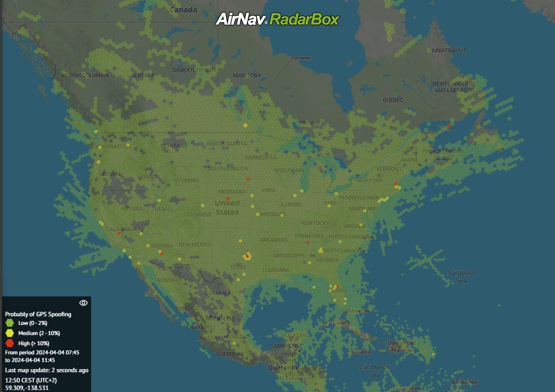
The GPS Accuracy Map’s colour-coded hexagons offer a clear visual representation of data accuracy:
- Green hexagons indicate areas where GPS data is consistently accurate.
- Yellow and orange hexagons suggest moderate probabilities of inaccuracies.
- Red hexagons signal that more than 10% of data in that region report low GPS accuracy.
It’s important to understand that red hexagons don't necessarily mean the data is inaccurate. Instead, they highlight areas where users should be cautious, as external factors such as weather conditions, terrain, or even GPS spoofing might be affecting the accuracy of the signals.
Understanding GPS Spoofing and Jamming
Beyond analyzing accuracy, RadarBox’s GPS Accuracy Map also helps users understand the risks of GPS spoofing—a practice that can disrupt aviation tracking and even pose significant risks to aircraft navigation systems.
What is GPS Spoofing?
GPS spoofing involves tricking a GPS receiver into calculating a false position. This can have severe consequences in aviation as pilots rely on GPS to determine their location and flight path. Spoofing incidents have been identified in areas of conflict, including Ukraine, Gaza, and recently between Israel and Lebanon, where GPS signals are intentionally disrupted. In this region, RadarBox has observed heightened spoofing activity that poses risks to military operations and civilian flights navigating the area.
Spoofing is often employed in conflict zones to confuse missile guidance systems or drones, but it can unintentionally affect aviation systems by scrambling the signals aircraft use for navigation. This can lead to inaccurate flight data and increase the risk for both commercial and military aviation.
The Difference Between Spoofing and Jamming
There are two primary methods of disrupting GPS operations:
- Jamming occurs when radio signals are broadcast to overwhelm a GPS receiver, preventing it from functioning correctly.
- Spoofing: This more sophisticated method sends false signals to a GPS receiver, causing it to display incorrect location data.
Both jamming and spoofing can compromise flight safety, so RadarBox's GPS Accuracy Map is essential for identifying areas of potential interference.
GPS Spoofing Observed Between Israel and Lebanon

GPS Accuracy Map provided by AirNav RadarBox

GPS Accuracy Map provided by AirNav RadarBox
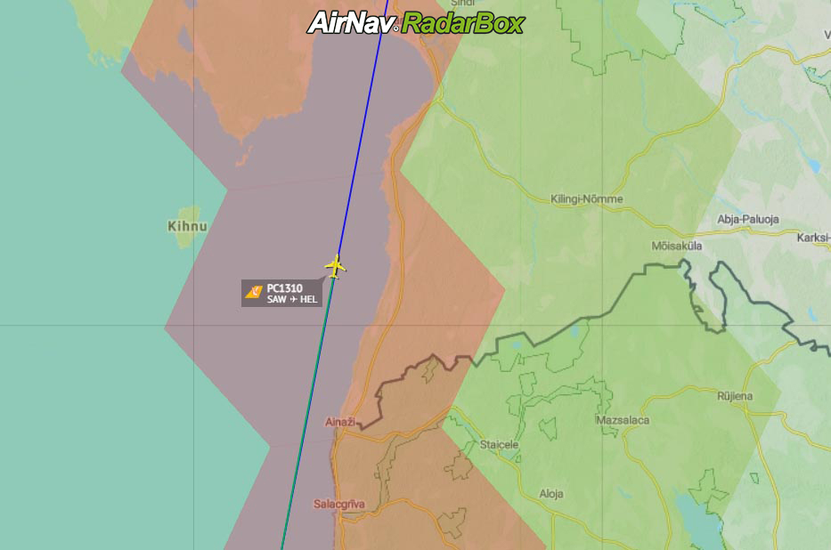
In the ongoing tensions between Israel and Lebanon, RadarBox has detected notable GPS spoofing activity in the region. These disruptions are likely linked to the conflict and military operations in the area. Users monitoring flights in this region have observed high spoofing probabilities, represented by red hexagons on the GPS Accuracy Map. This helps to provide crucial situational awareness, alerting pilots, aviation professionals, and flight trackers to potential risks.
Enhancing Safety and Awareness
With its color-coded GPS spoofing legend, RadarBox provides an invaluable layer of information for users. Spoofing probabilities are categorized into:
- Low (0-2%)
- Medium (2-10%)
- High (>10%)
This feature lets users stay informed about the potential risks of GPS manipulation and make more informed decisions when analyzing flight data. By understanding spoofing risks and the likelihood of inaccuracies in specific regions, RadarBox users gain unparalleled situational awareness.
How to use this feature
GPS Accuracy Map provided by AirNav RadarBox
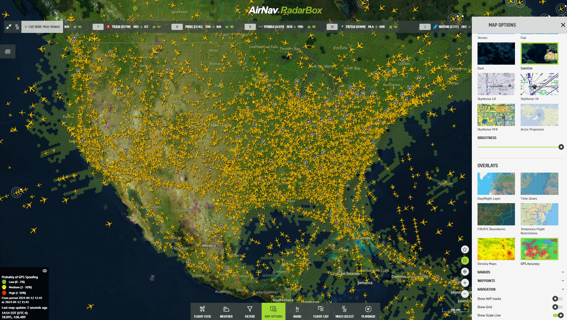
Click on "Map Options" and proceed to "Overlays," where users can effortlessly activate the "GPS Accuracy" layer. This simple process unlocks a treasure trove of insights, placing unprecedented precision and clarity at users' fingertips.