New update is available for RadarBox apps

The Image Above: RadarBox app available for Android and iOS
As part of AirNav RadarBox's constant development to offer the best flight tracking experience, we've recently updated our apps to version 2.3.3 improving the user experience and adding new features, as well as refactoring existing features. What's new?
- Filters available for spotters and bug fixes
- Filters: Refactored & Easily Accessible
- New fully customizable aircraft labels
- New Airport & Airline Lists
- Social Media Links
- Added Miles unit to distance settings
- Bookmarks
- ATC Boundaries
- Last Trails
- Pull to refresh included to the flight page
- New Airport Markers & Icons
1. Filters
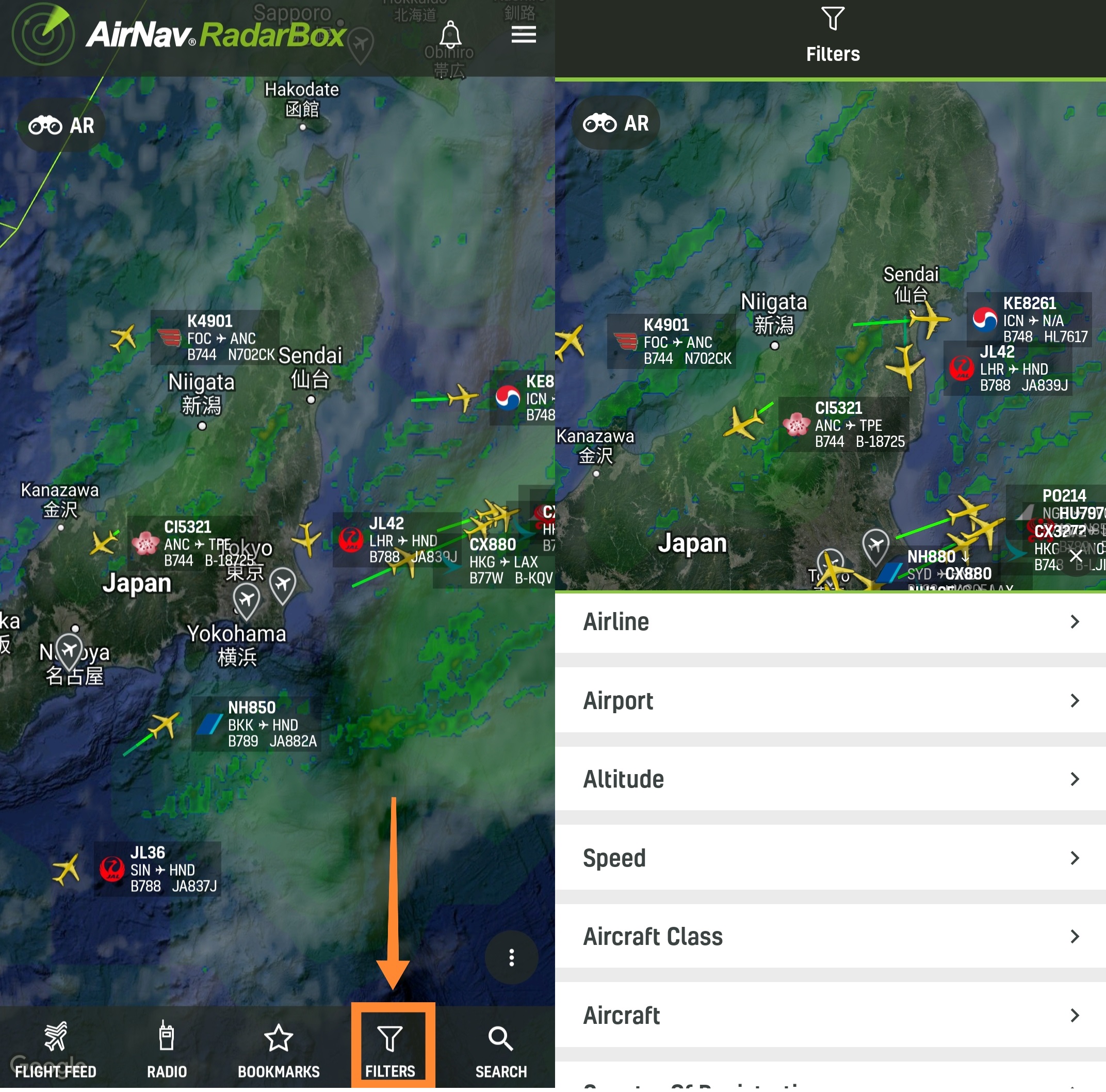
The Image Above: Filter displayed in the RadarBox app
The filters feature available in the RadarBox apps has been redesigned to be easier to use. You can now use them by clicking on "Filter" and choosing which filter you want to activate in the RadarBox app. You can filter by:
- Airline
- Airports worldwide
- Altitude & Speed
- Aircraft class (Airline, General Aviation, Military, Business, etc.)
- Aircraft
- Country of Registration
- Status (On-Air & On Ground)
- Sources (ADS-B, FAA SWIM, MLAT, UAT, SAT ADS-B, OCEA, ADS-C, HFDL, and ASDE-X)
2. Aircraft Labels

The Image Above: Aircraft Label in the RadarBox app
Also, in this update, we've brought the aircraft label where you can activate the aircraft label on the RadarBox map and view certain types of information while navigating our app. To activate RadarBox aircraft labels is simple, just select the map options and look for the "Aircraft Labels" option and select "Always Show (Under 30 Aircraft)," and choose which information you are interested in being displayed. Among these options:
- Climb/Descend Indicator
- Airline Logo
- Flight Number
- Route
- Model
- Registration
- Altitude/Speed
3. Airport & Airline Lists

The Image Above: Airport List displayed in the RadarBox App
The airports and airlines lists were also updated with more information. In the case of airports, the options of nearby airports and information such as METAR, TAF, Info (elevation, local time, weather, dew point, pressure, wind direction, visibility, allowed flight category, runway in use for takeoffs and landings had been added.
4. Social Media

RadarBox Social Media Icons displayed in RadarBox app
When you open the settings option, the icon of all our official social media will be displayed. You can follow us and receive the latest aviation news. Follow us on Twitter - https://www.twitter.com/radarbox24.
5. Distances (Miles)

The Image Above: Tutorial on how to enable the Miles unit in the RadarBox App
Among the distance units available in RadarBox (Kilometers, nautical miles), we also added the miles unit to provide more distance options for our users, mainly based in the USA. To change the distance unit to miles, go to "Map Option" and select "Miles".
6. Bookmarks

The Image Above: Bookmarks displayed in the RadarBox Apps
As part of our development of updates, we have recently brought bookmarks into the RadarBox app. With this feature, you can create bookmarks for airports, flights, geographical points, and more. To create bookmarks, just fill in the blanks and click save.
7. ATC Boundaries

The Image Above: ATC Boundaries displayed in the RadarBox App
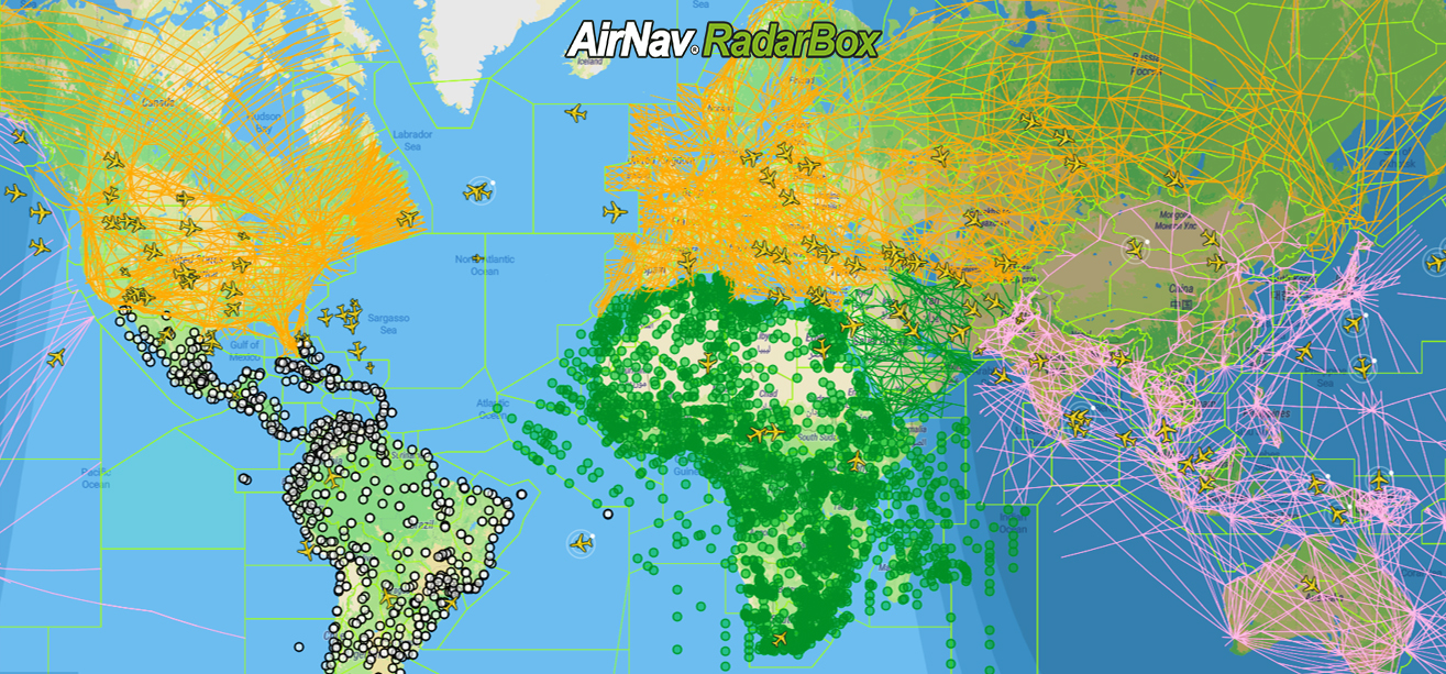
The ATC boundaries refer to FIR areas, or Flight Information Areas, the designation given to the portion of airspace where the countries' airspaces are divided in order to provide better & efficient air traffic monitoring services. This feature is now available in the RadarBox app in order to offer more information to our users, especially aviation professionals. To display ATC boundaries on the map, go to "Map Options", and select "ATC Boundaries".
8. Last Trails

The Image Above: Last Trails in the RadarBox App
Last Trails was also one of the RadarBox.com features that was implemented into the RadarBox app. The feature named "Last trails," displays the flight trails over the last 5 minutes at a specific location or airport. This feature is available when less than 50 aircraft are visible.
To activate this feature in the apps, just go to "Map Options" and select the "Show Last Trails" option.
9. Airports Icons

The Image Above: Airports Icons in the RadarBox Apps
Airport icons or markers have also been added to the map in the RadarBox apps. With this feature available in our apps, you can now enable or disable the airport icons. It is simple, just go to "Map Options", and click on "Airport Icon".
Other app improvements
Besides all these features and updates implemented in the RadarBox apps recently, we've also improved the app's performance as well as the design (the menu bar); all this to improve the user experience with usability and ease of use in mind.
Do you have any questions or feedback? Please send us a tweet with the hashtag #RadarBox or send us an email with your problem/question to: [email protected]
To enjoy these features and updates, why not consider subscribing to RadarBox? Click here to subscribe!
Download our apps now: