New 3D Map Updates: Runway Extensions, NAT Tracks and Enhanced Weather Layers
Temporary Flight Restrictions (TFRs) in 3D
We’ve added a new set of updates to our 3D map, bringing more detail and aviation information to the tracking experience. The latest improvements bring additional data layers to the platform, including NAT Tracks, Temporary Flight Restrictions (TFRs), GPS Accuracy, turbulence, icing, volcanic activity, AIRMETs, and SIGMETs. These updates are available directly through the map and weather layer options, giving users more control over the information displayed on screen.
Improved 3D Experience
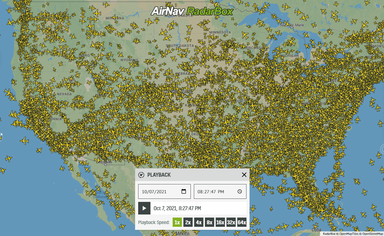
Density Maps are also available in the new 3D Globe, providing a visual representation of the main airways and flight paths used by aircraft for navigation.
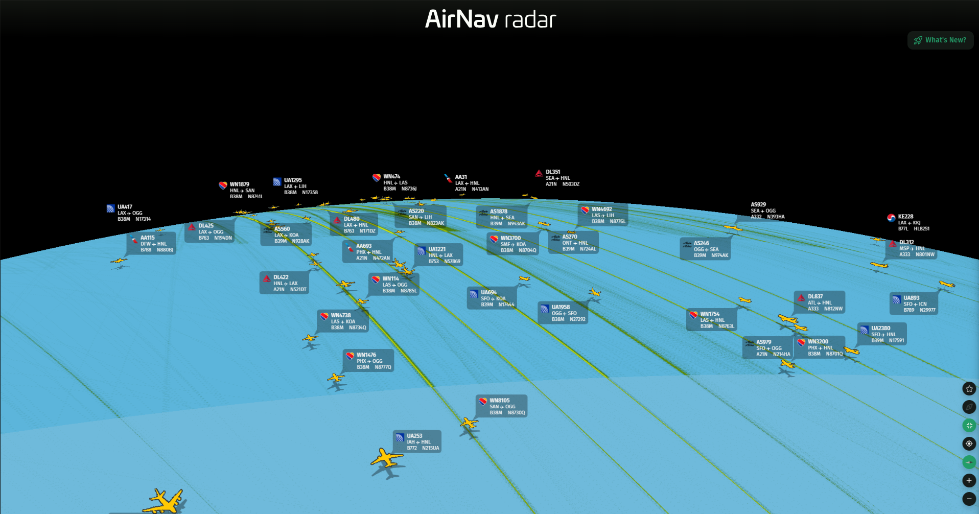
Density Map in 3D
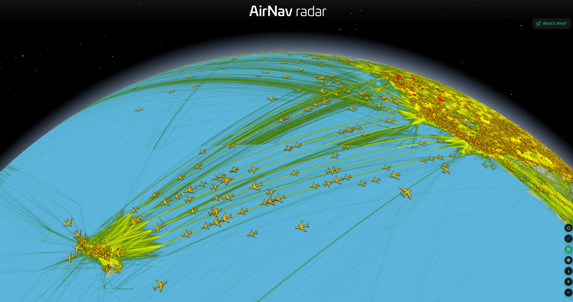
Density Map in 3D
Our 3D map continues to evolve with a more detailed way to explore airports and aircraft activity. One of the latest improvements is the addition of runway extensions, which provide a clearer representation of airport runways in the map environment. This makes it easier to understand airport layouts, runway orientations, and surrounding areas while tracking aircraft in real time.
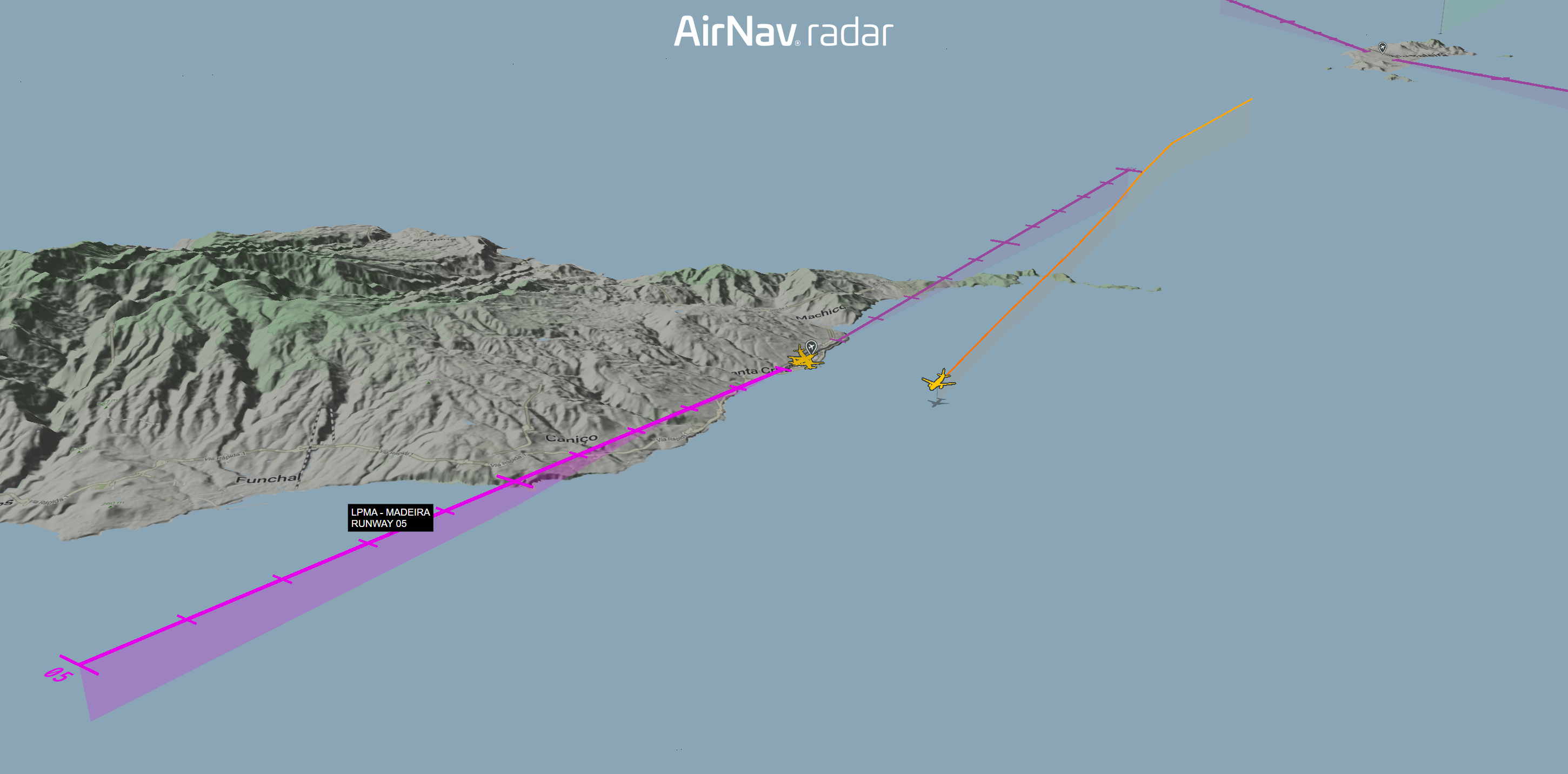
Runway Extensions in 3D
The 3D experience can also be used alongside other map layers, allowing users to combine aircraft tracking with additional aviation and geographic information.
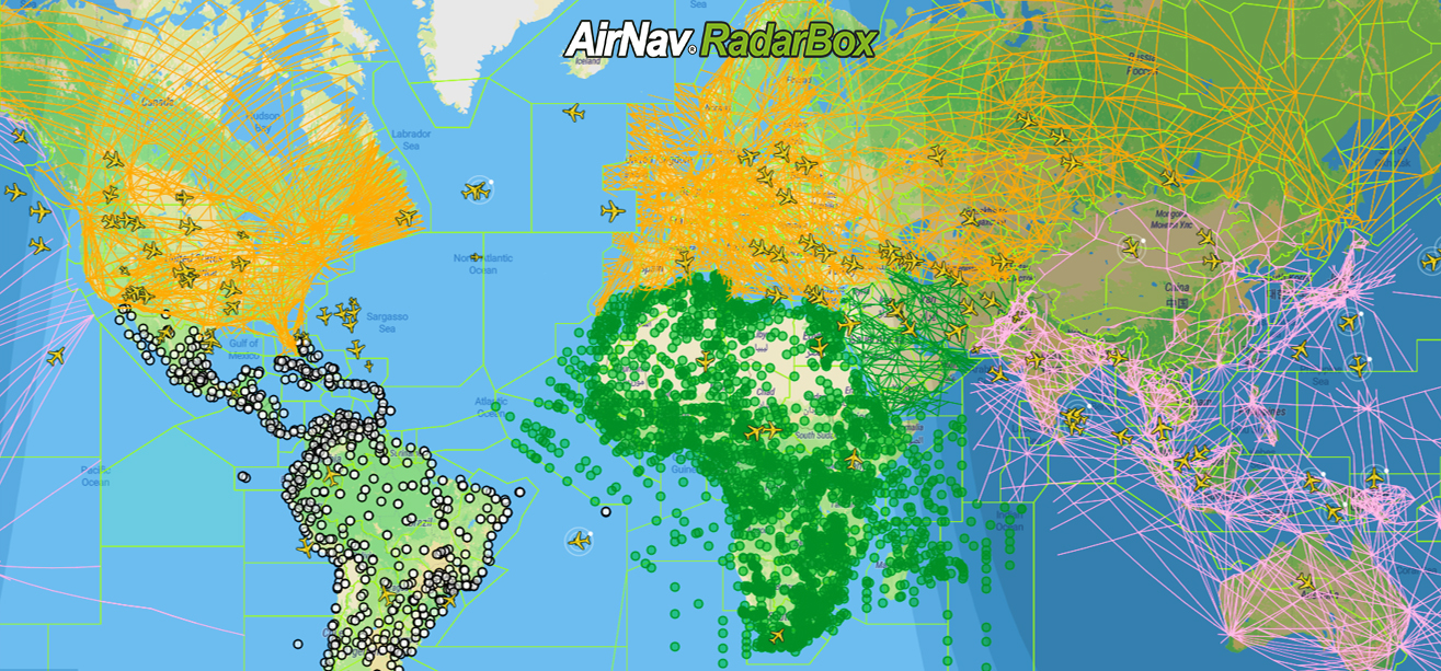
NAT Tracks
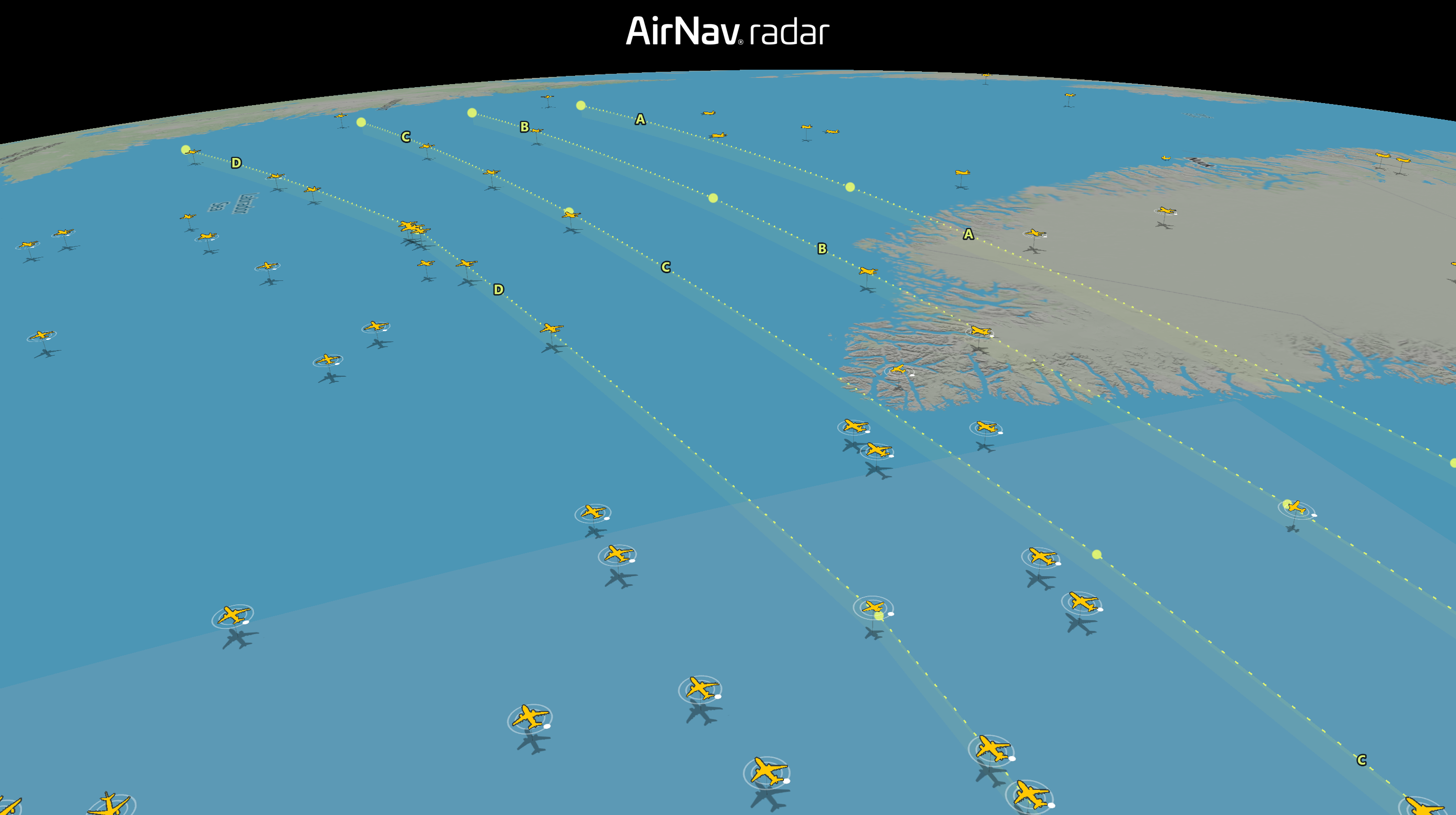
For users interested in transatlantic aviation, North Atlantic (NAT) Tracks can now be displayed directly on the map.
NAT Tracks are established routes used by aircraft crossing the North Atlantic, with route structures changing according to operational requirements, traffic demand, and prevailing conditions.
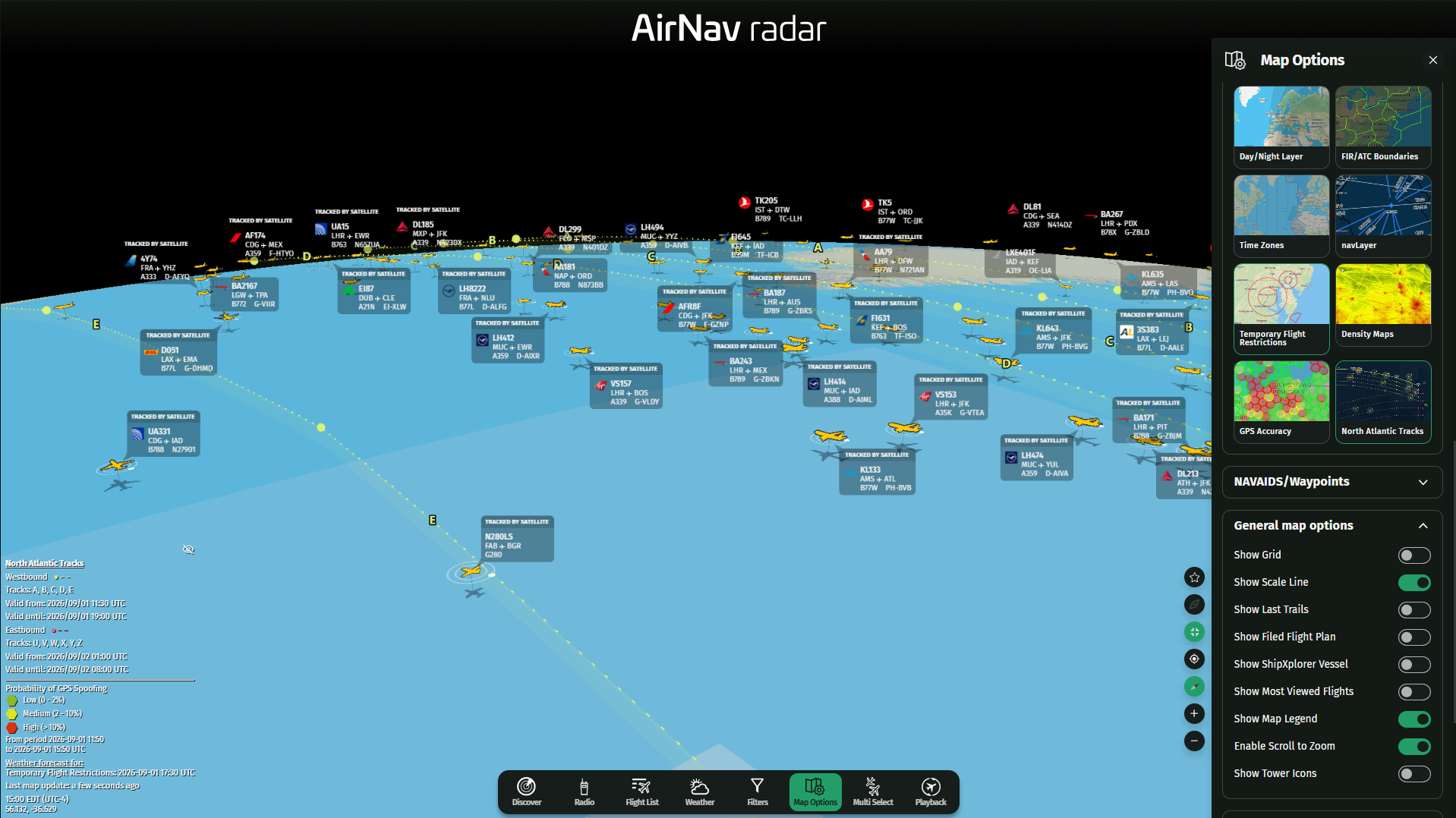
How To Use NAT Tracks in 3D
To display NAT Tracks:
- Open Map Options.
- Select Globe to switch to the 3D view.
- To rotate, tilt, and explore the 3D map, hold Ctrl on Windows or Control (⌃) on Mac while moving your mouse.
- To display North Atlantic Tracks, select NAT Tracks in Map Options.
- The available tracks will appear directly on the 3D map.
The layer can be used alongside other map information to provide a broader view of aircraft operations across the North Atlantic.
Temporary Flight Restrictions
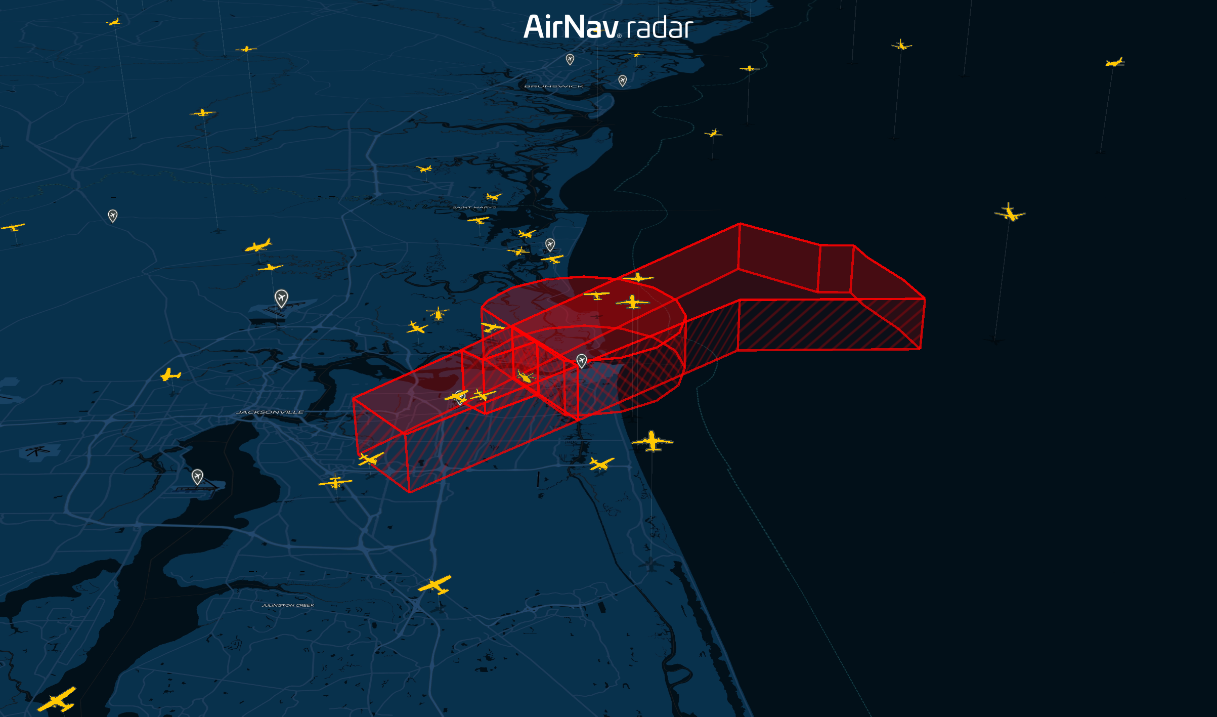
You can also visualize Temporary Flight Restrictions (TFRs) directly on the map. TFRs are temporary airspace restrictions established for specific operational, security, emergency, or other purposes. Displaying them alongside live aircraft traffic can provide additional context when monitoring activity in a particular area.
Temporary Flight Restrictions (TFRs) in 3D
To enable the TFR layer:
- Open Map Options.
- Select Globe to switch to the 3D view.
- To rotate, tilt, and explore the 3D map, hold Ctrl on Windows or Control (⌃) on Mac while moving your mouse.
- Select Temporary Flight Restrictions in Map Options.
- The applicable restrictions will be displayed directly on the 3D map.
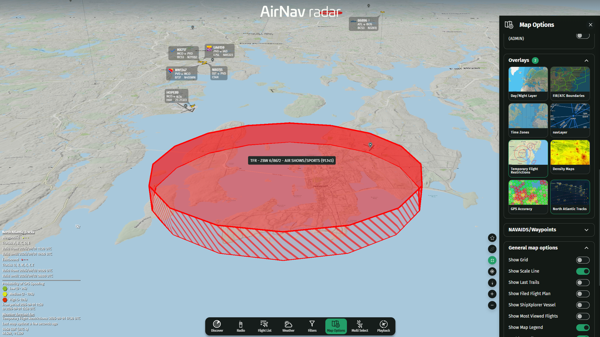
How to Activate Temporary Flight Restrictions (TFRs)
GPS Accuracy
The same menu also provides access to the GPS Accuracy layer, which helps users better understand the positioning accuracy associated with aircraft displayed on the map.
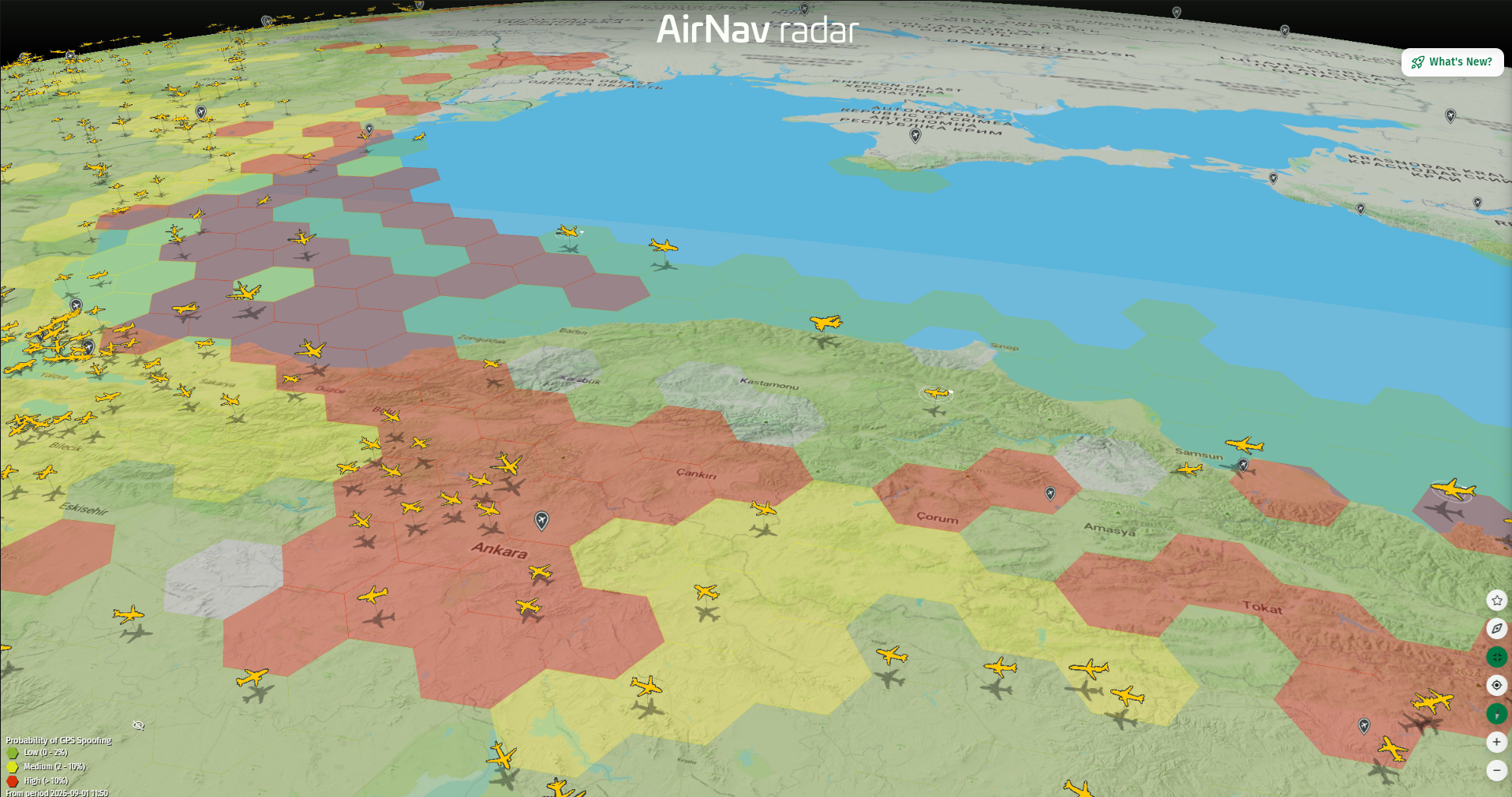
GPS Spoofing near Black Sea between Turkey and Ukraine (North)
Updated Aviation Weather Layers
The latest release also brings improvements to our aviation weather visualization. Open the Weather menu to access several aviation-specific layers. Each can be enabled individually, allowing you to focus on the information most relevant to your tracking and monitoring needs. Available layers include:
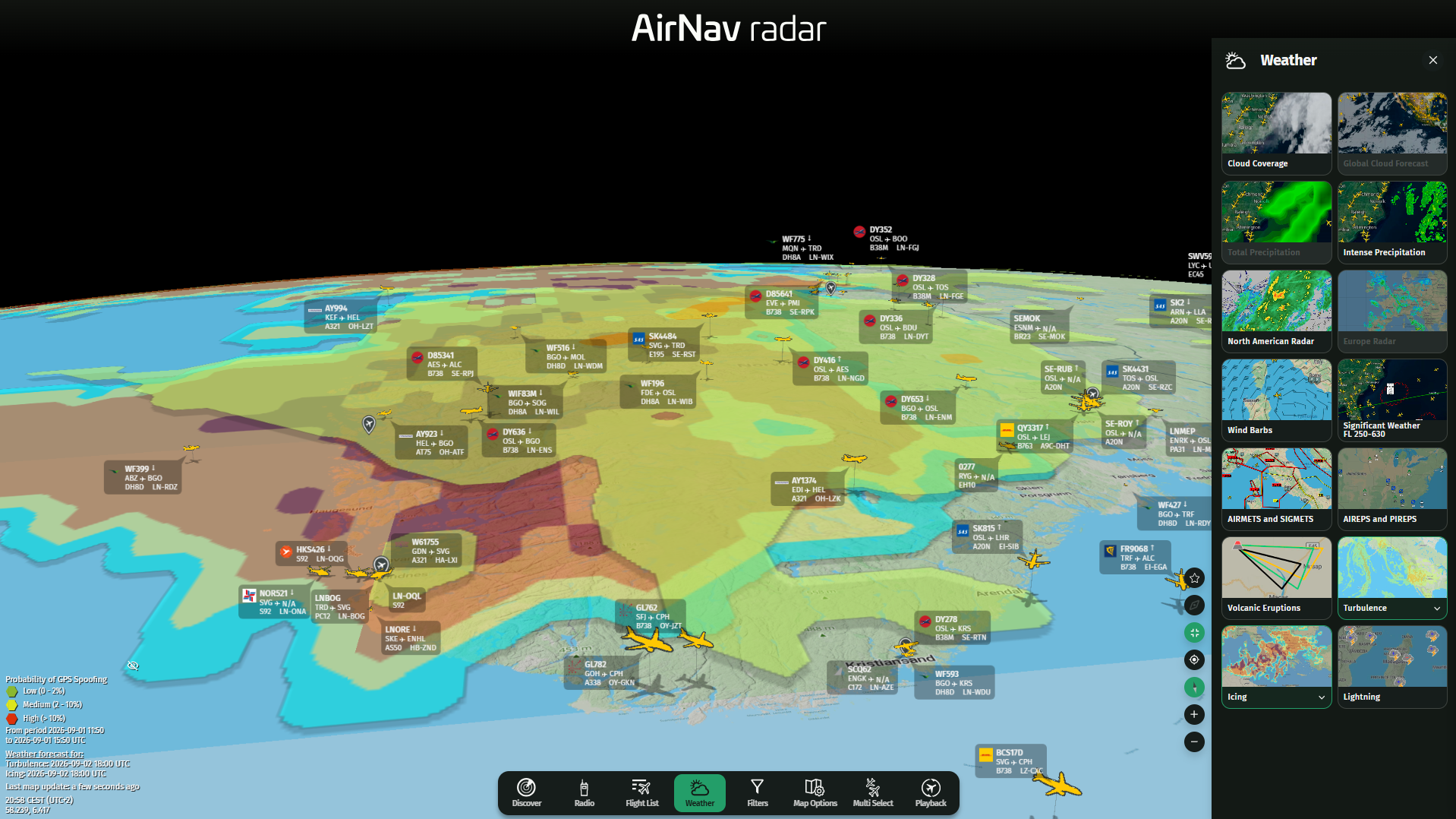
How to Activate Weather Layers in 3D
Turbulence
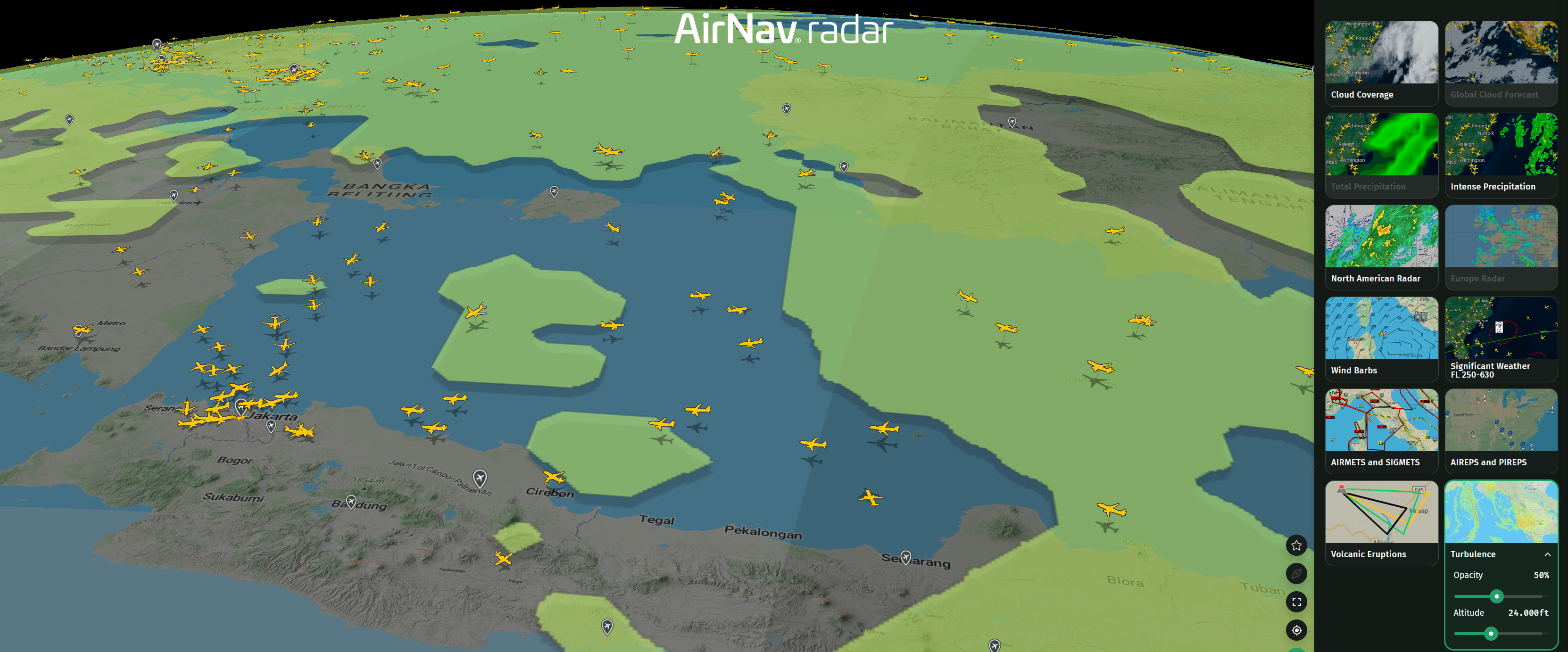
Turbulence Layer in 3D
The turbulence layer provides a visual representation of turbulence-prone areas, helping users identify potential atmospheric disturbances along flight paths.
Icing
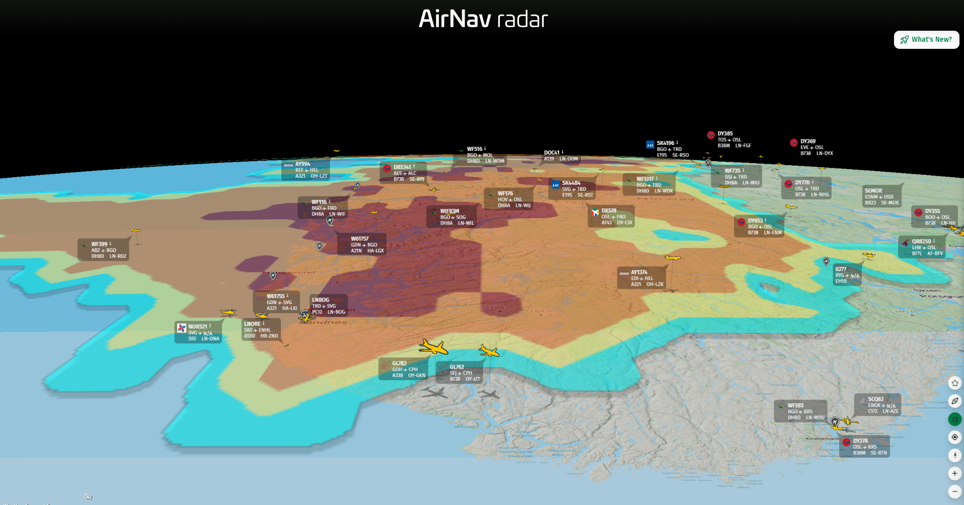
Icing Layer in 3D
The icing layer highlights areas at risk of aircraft icing, providing another useful piece of information for examining flight operations and weather conditions.
Volcanic Activity
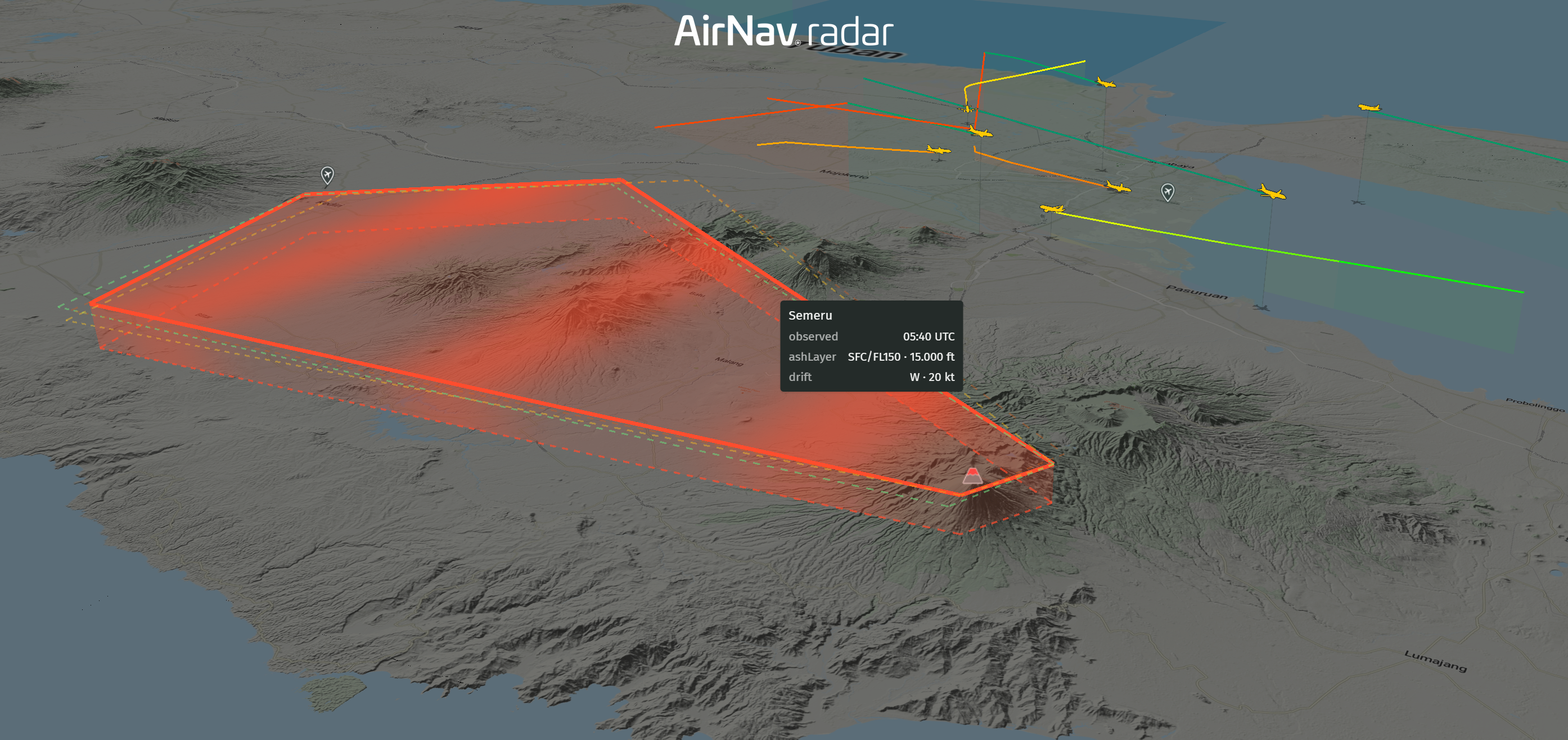
Volcanic Activity in 3D
Volcanic activity can significantly impact aviation, particularly when volcanic ash is present in the atmosphere. This layer provides additional geographic context when monitoring aircraft activity in affected regions.
AIRMETs and SIGMETs
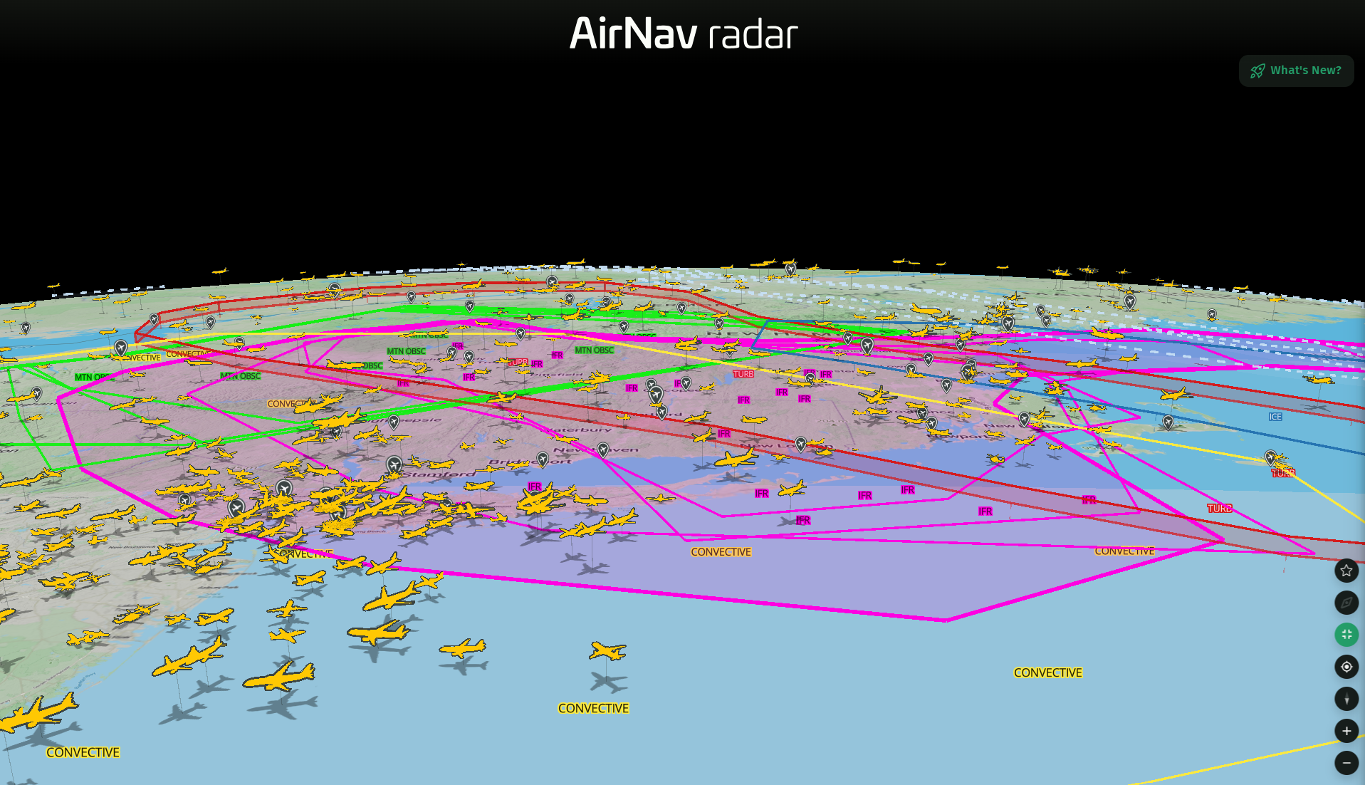
AIRMETs and SIGMETs in 3D
AIRMETs and SIGMETs have also been updated as part of the latest weather improvements. These aviation weather advisories provide important information about potentially significant weather and atmospheric conditions affecting flight operations.
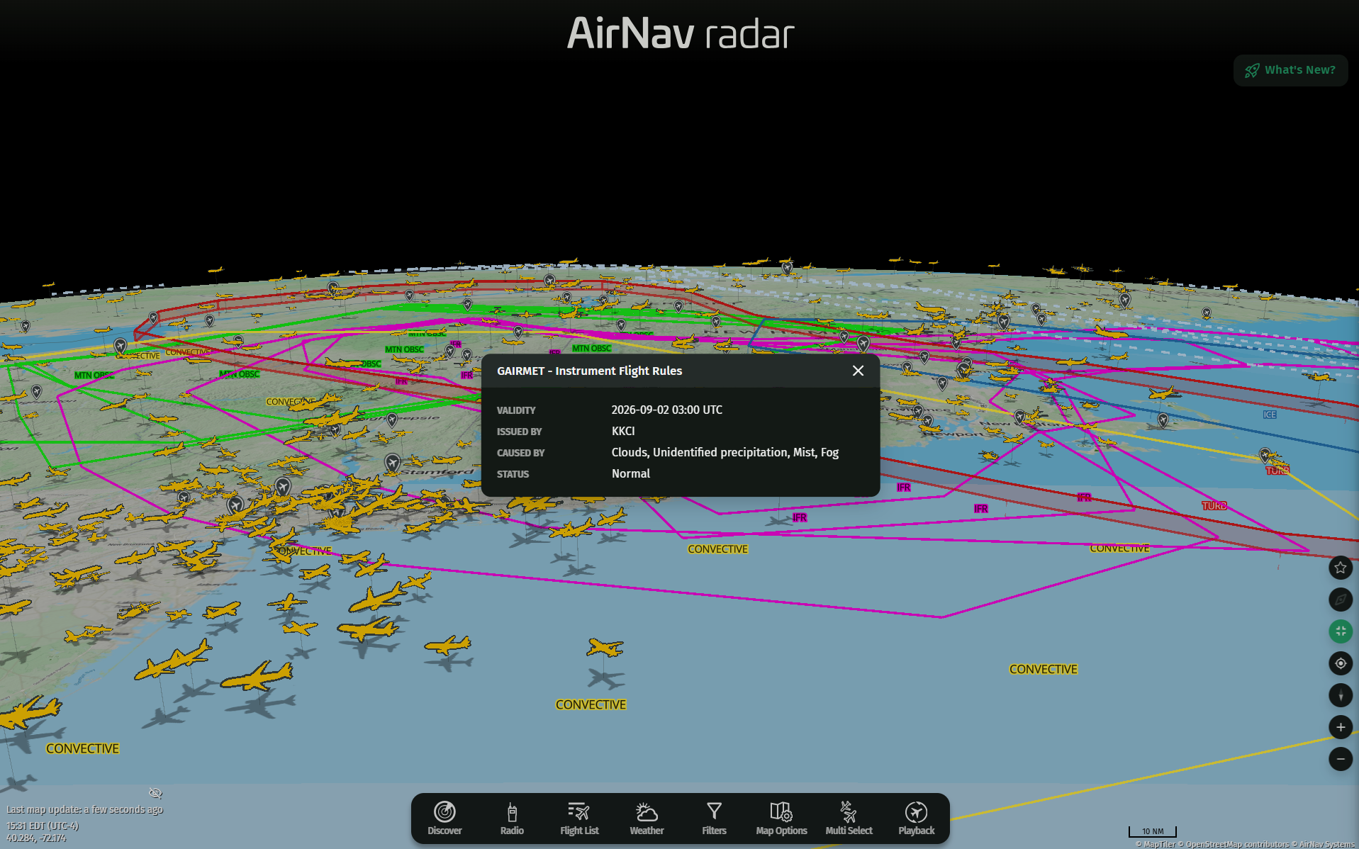
AIRMETs and SIGMETs in 3D
You can now combine live aircraft tracking with:
- NAT Tracks
- Temporary Flight Restrictions
- GPS Accuracy
- Runway extensions
- Turbulence
- Icing
- Volcanic activity
- AIRMETs
- SIGMETs
- 3D map visualization
Each layer can be turned on or off based on what you want to see, allowing you to create a customized map experience for different types of aviation monitoring.
Try the Latest Updates
All of these features are available directly on our website.
Open the map, explore the Map Options and Weather menus, enable the layers you want to see, and experience the updated 3D environment.